 Photo
Gallery
Scars and Ruptures from 7.9
Denali Fault Quake
Photo
Gallery
Scars and Ruptures from 7.9
Denali Fault Quake
November 12, 2002
Tuesday - 10:00 pm
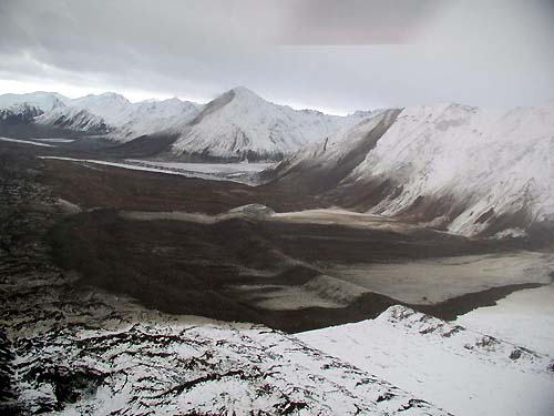
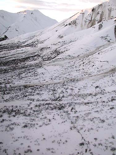
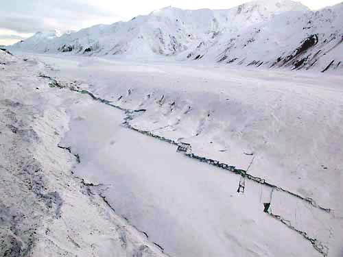 Trace of the Denali Fault
running up the north side of the Canwell Glacier about 10 miles
east of the Richardson Highway.
Trace of the Denali Fault
running up the north side of the Canwell Glacier about 10 miles
east of the Richardson Highway.
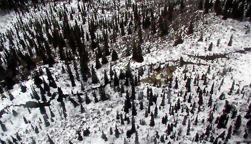 A fault trace visible in trees
southeast of Tok Cutoff Highway.
A fault trace visible in trees
southeast of Tok Cutoff Highway.
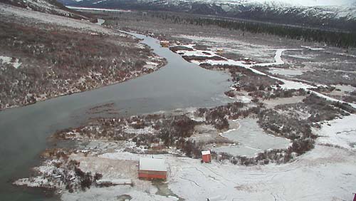 Liquefaction, spreading and
settling at the north end of Fielding Lake, which is about 11
miles south of the Denali fault. Note the tilted buildings.
Liquefaction, spreading and
settling at the north end of Fielding Lake, which is about 11
miles south of the Denali fault. Note the tilted buildings.
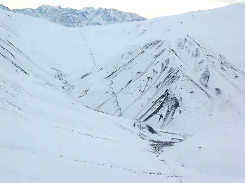
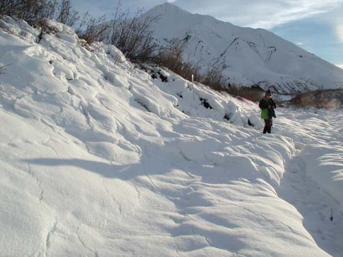 Near the head of Slate Creek,
a stream bank offset of 3.3 m is visible; larger offset including
drag along fault was roughly 11 feet.
Near the head of Slate Creek,
a stream bank offset of 3.3 m is visible; larger offset including
drag along fault was roughly 11 feet.
 These two rockslides flowed
a mile northward over the Black Rapids Glacier. They were the
largest observed. They are about 12 miles west of the Richardson
Highway.
These two rockslides flowed
a mile northward over the Black Rapids Glacier. They were the
largest observed. They are about 12 miles west of the Richardson
Highway.
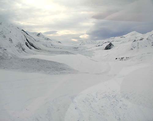 Snow and ice avalanches on
the Gakona Glacier.
Snow and ice avalanches on
the Gakona Glacier.
A fault trace is dimly visible in foreground.
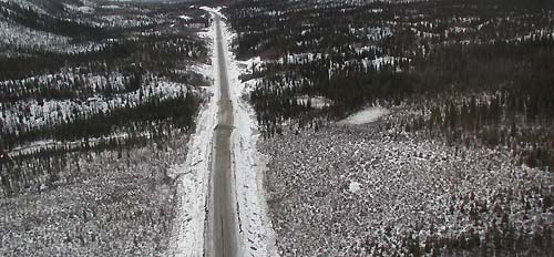 Fault offset of Tok cutoff
highway.
Fault offset of Tok cutoff
highway.
On the ground researchers estimated offset as 22 feet.
 Totschunda fault trace. A
significant finding of the initial surveys was that the Totschunda
fault ruptured during the earthquake. The Totschunda fault connects
with Denali fault, is located at the southeastern extent of the
rupture zone, and the fault has a more southeasterly trend than
the Denali fault.
Totschunda fault trace. A
significant finding of the initial surveys was that the Totschunda
fault ruptured during the earthquake. The Totschunda fault connects
with Denali fault, is located at the southeastern extent of the
rupture zone, and the fault has a more southeasterly trend than
the Denali fault.
 A view northwest along the
Totschunda fault at the SE most extent.
A view northwest along the
Totschunda fault at the SE most extent.
 A easily visible fault trace
near Chistochina River.
A easily visible fault trace
near Chistochina River.
Source of 11/07/02
Photographs:
United States
Geological Services
Web
Site
Post a Comment View Comments
Submit an Opinion - Letter
Sitnews
Stories In The News
|